| MadSci Network: Earth Sciences |
Hi Eric:
According to this site, the bow section of the Titanic (which is the biggest piece) lies at 41o 43' 57" north latitude, and 49 o 56' 49" west longitude, which is just off the North American continental shelf (in a region called the "continental slope"), to the southeast of Newfoundland. It lies a little over 3800 metres below the surface. As far as water masses, that would put it in what us oceanographers call "North Atlantic Bottom Water", which has a characteristic temperature of about 2.5 oC, and a salinity of about 35 ppt.
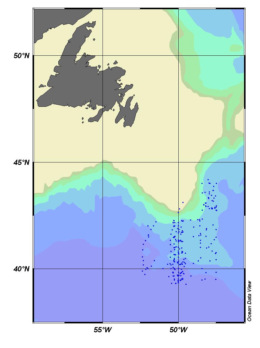
Conditions in the deep ocean don't change very much - to illustrate this, I went and downloaded some temperature and salinity data collected in the area of where the Titanic lies, from the US National Oceanographic Data Centre - to get a good idea of the temperature and salinity in the area, I took data in a box 5 degrees wide in terms of latitude and longitude, and centred on the wreck location (so it covers an area of about 1500 square miles). In that area, I found data from 295 stations, collected between now and the 1930's at various times of the year. Here's a map of the location of the stations:

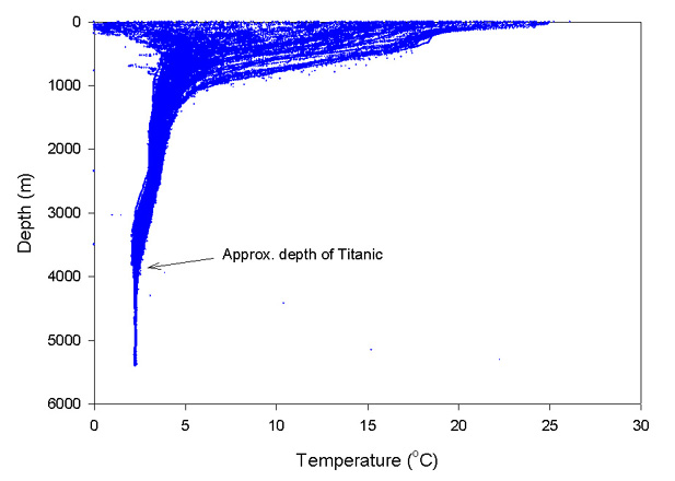
There is a total of a little over 136000 separate data points. That's quite a lot of data, and forms a bit of a cloud when I plot them up (each measurement is an individual point, but it's hard to show individual points when there's so many). Here is temperature:

As you can see, temperature is very variable in the surface waters (above 1000 metres or so), that's because these measurements were taken at various times of the year - the cold samples would be from winter, and the warmest samples from in the summer. You can however also see that there is considerably less variability at the depth that the Titanic lies at - maybe about one degree Celsius. That's pretty small, considering that these measurements were made on a pretty large area. You can see that there's a few oddball points at depth - those are a few bad data points.
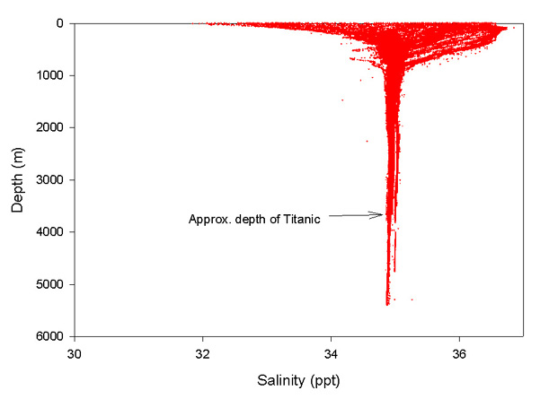
Looking now at salinity, we see that it is similarly consistant at depth:

I hope that answers your question!
Rob Campbell, MAD Scientist
{Admin note: In this context 'ppt' for salinity units means 'parts per thousand (by mass)' ;
In other areas of environmental chemistry 'ppt' usually means 'parts per trillion', which is very
different!}
Try the links in the MadSci Library for more information on Earth Sciences.